Tolkien once said that he considered it a wise move to start Middle Earth with a map. (If I’m not mistaken, he actually started with FULL-BLOWN INVENTED LANGUAGES, but that’s beside the point.)
The point is, anything Tolkien ever said aside, creating imaginary maps is creative, euphoric bliss!
Someone please pay me to create maps for a living.
At long last, I took the paper fantasy map I’d designed and made a rough copy of it on Inkarnate (a site for designing visually grabbing full-color maps). Check it out!
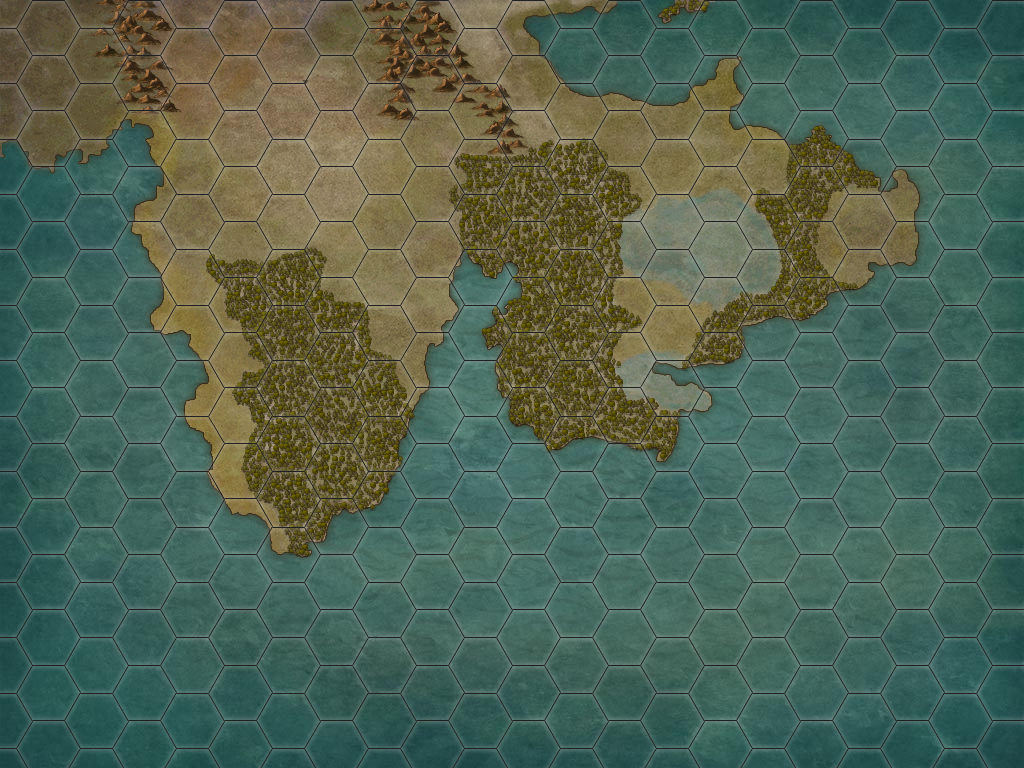
The size of what you see is somewhat equivalent to the size of North America (by my recollections). You’ll notice the continent extends further northward and westward. There are also other continents not shown because, naturally, my world is well-sized! However, all the kingdoms of the world and any important locations are shown on the map.
(Those blue patches, by the way, are wetlands.)
This isn’t the final edition (in fact, it’s slightly disproportionate compared to my first sketch). However, I love it. It helps the world come alive.
Someday soon guys, I hope to have the story done that goes with this map!
Thanks for your patience. 😉